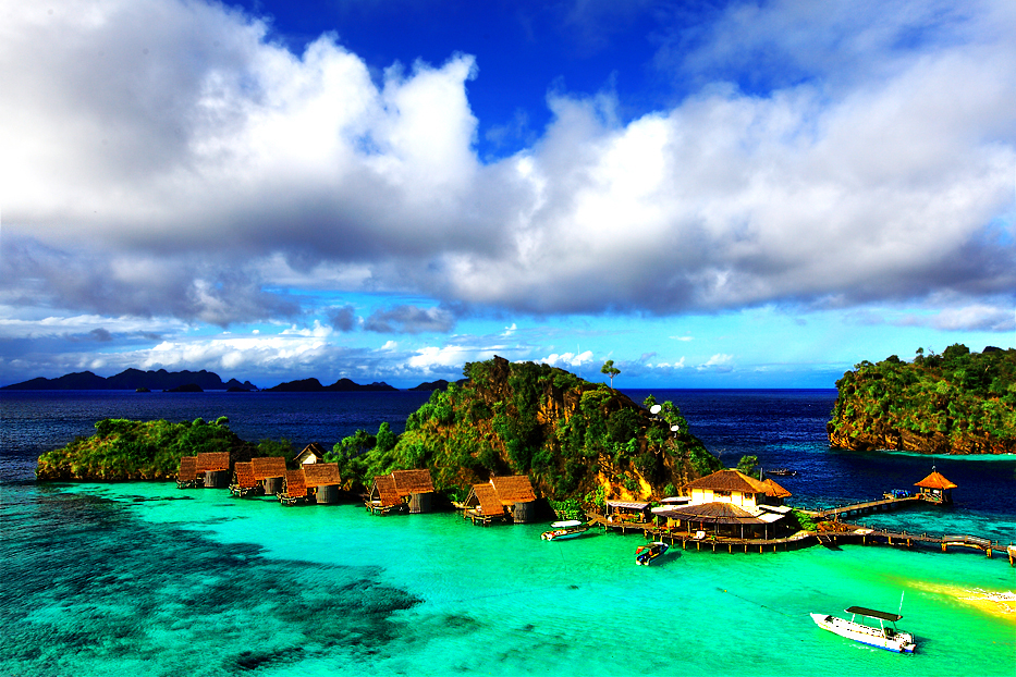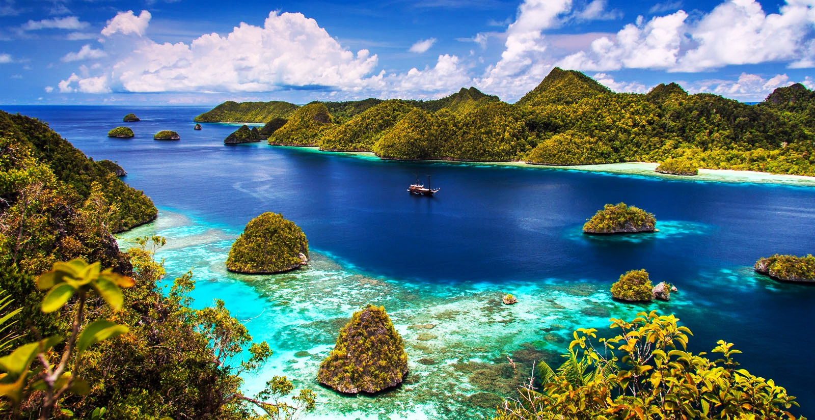
Raja Ampat Islands consist of a series of four
islands are very close together precisely located at the westernmost tip of the
island of Irian (Papua) parts of the Bird's Head. Raja Ampat has an area of
approximately 881 953 km2, with a land area of only about 6084.50 km2, the
remainder consisting of the oceans, with the geographic location of the
position 2º25 'N - 4º25' latitude and 130 ° - 132º55 'BT. This district
consists of 610 pieces of small islands, and there are four large islands, the
island chain consists of Waigeo Island, Misool Island, Salawati Island and
Island Batanta.
To reach this tour if you are using the aircraft
through the air port service flights Sorong ie Domine Eduard Osok, after that
you can go to the island via the dock crossings between islands using public or
express ferry and speedboat.

This region consists of many islands and narrow
straits, resulting in most of the other dive destinations have a strong
current, it is very exciting because the diver does not require much effort in
doing this sport while looking beauty charm coral reefs and various species of
fish are very beautiful

Famous beaches there are: Waisai Terong Cinta Beach,
Waiwo Beach, Pine Beach, Yeben beach, and the beach Arborek which are included
in some of the most beautiful beaches in Indonesia, with white sand gently
sloping natural scenery consists of a cluster of islands small very beautiful
and charming.

At least there are three facts that make raja Ampat being
famous in the world. First, Raja Ampat area was accidentally discovered. At
that time, a Dutchman diver named Max Ammer visited this region.
The goal initially was to explore the existence of aircraft and vessels used in
World War II estimated the shipwrecked kawasasan. It turns out Max Ammer very
fascinated by the diversity of biota in Raja Ampat Then in 1998 he was invited
Gerry Allen, a fisheries expert from Australia, to conduct a survey in this
place. The search for the wreck and the plane itself was also fruitless. In the
bottom of the sea islands of Raja Ampat found some relics of former wars,
including the war machine, ships and airplanes former World War II. Thus,
arguably, wealth Raja Ampat is not only the diversity of biota, but also its
historical wealth.

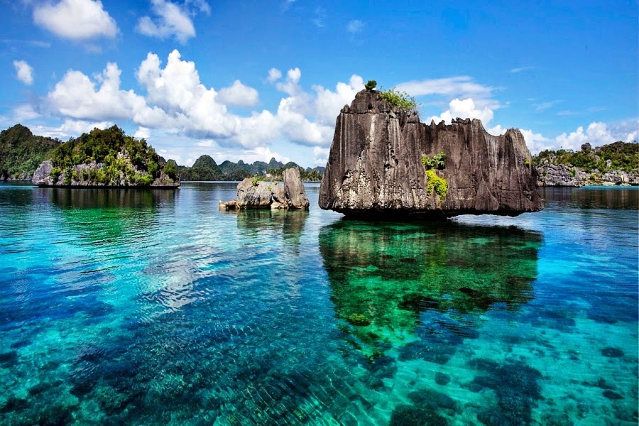
Second, Raja Ampat is a paradise of coral reefs.
There are some reefs are still in pristine condition with the percentage of
live coral cover up to 90%, ie in Dampier Strait (strait that separates the
island Waigeo and Batanta Island), Kofiau Islands, Islands and South East
Misool Wayag Islands. Types of coral reefs in Raja Ampat is generally a
fringing reef with the contours of steep ramps up. But it also found the type
of atoll and the type of burns or taka. For those who can not dive too, coral
reefs can still be enjoyed, namely the village Saondarek. When the lowest
tides, there can be seen coral reefs can still be alive despite being in the
open air and exposed to direct sunlight.

Third, Raja Ampat is one of the best dive sites in
the world. There are several well-known diving spots in Raja Ampat, such as
Manta Point, Mike's Point, Sardine Reef and Shark Point. Each point has its own
privileges. For example, in Manta point, can easily be found fish Manta with a
diameter of 9 meters and down around you. Around the islands Kaboei Bay Rock
there is a bay which is a tunnel underneath a rock. In Kaboei Bay Rock also
found coral caves inhabited by bats, and in some places are found remains of
human bones. Because the area of many islands and narrow straits, then most of
the dive at a particular time has a strong current. It is also possible to do a
drift dive, dive, following the strong current with very clear water as he
broke through schools of fish. Special again, there are still many coral reef
sites that have not been touched.