Sunday, March 27, 2016

Beautiful Scenary from South Kalimantan


South Kalimantan is one of the provinces in Indonesia, located in the southern part of the island of Borneo. Its capital is Banjarmasin. South Kalimantan Province has an area of 37.530.52 km ². South Kalimantan peovinsi boundaries are: the west by Central Kalimantan Province, east with Makassar Strait, south of the Java Sea and the north with the province of East KalimantanSouth Kalimantan Province has a lot of natural beauty which are as follows:

1. Pantai Batu Lima (Batu Lima Beach)
Pantai Batu Lima is the beach which is in the district of Tanah Laut, South Kalimantan. The beach location Batu Lima precisely located in the village of Kuala ferry. Pelaihari of the city which is the capital district of Tanah Laut, Batu Lima beach location is approximately 35 km. Meanwhile, when departing from the provincial capital of South Kalimantan, Banjarmasin then the distance can be more than 80 km.
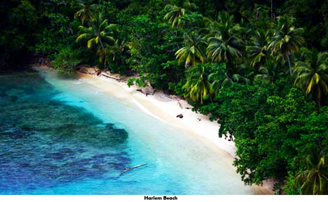
Around the coast of Batu Lima overgrown by a kind of pine trees neatly lined up in a row along the beach. This tree is quite high measuring approximately 5 meters. The leaves are thick can make the bottom of the tree becomes cool. In addition to these trees are also grown mangrove trees at some point. Right under the trees meet the coastal Batu Lima there are green grass that covers the surface of the sand.


2.  Air Terjun Bajuin (Bajuin Waterfall)
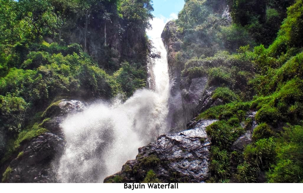
Bajuin Waterfall is located in the village of River Grill, District Pelaihari within approximately 10 km of Capital Tanah Laut regency and about 75 km from Banjarmasin.Bajuin Waterfall have a beautiful mountain panorama, exotic, and the air was still very cool because of the many trees. In this area there are three waterfalls with different heights, because nature is still beautiful and natural.


3. Cagar Alam Pulau Kaget (Pulau Kaget Nature Reserve)
 
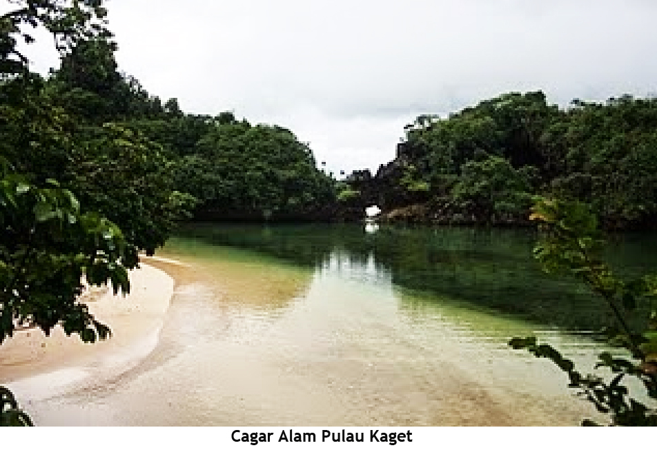
Pulau Kaget (Kaget Island) is a delta-island formed by the sediment of mud which grew from the river bed. Administratively, the island is located within Tabunganen sub-district, in the Barito Kuala Regency, South Kalimantan Province with an area of 85 ha. The fertile soil of the island provides much needed minerals to the various vegetation that grows on it, thus creating a dense forest which became the habitat of various wildlife. 


4. Pulau Sebuku (Sebuku Island)
Sebuku Island is an island and also a districts in Kotabaru, South Kalimantan, Indonesia. The island is located east of Sea Island and west of the island of Sulawesi. The beach is located in the village Sekapung has a unique character as the rocks and sand colored slightly yellowish combined with a blue sky background.
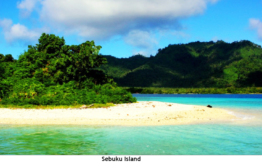
To reach this Sebuku Island takes about 12 hours by road from Banjarmasin. By passing the land between Banjarmasin and Batulicin. Then, followed by a ferry ride to the Port of Tanjung Serdang, Kotabaru. After that, by using the car down the track overland to Kotabaru. After that, it can use a speed boat to get to the River Bali, the capital districts Sebuku Island.


5. Goa Temuluang (Temuluang Cave)
Temuluang Cave is known as the largest producer of swallow nest in South Kalimantan. The layout of the cave is located on the east Banjarmasin (350 kilometers) and 150 kilometers north Kotabaru. Temuluang very dark. Therefore, a flashlight or head lamp into absolute completeness.
Gurgling water falling from stalactites and a flock of swallows that fly in and out of the cave is quite creepy atmosphere. Only the voices that broke the silence and darkness. By calculating the price of bird's nest around Rp 3.5 million per kilogram, the value of production of swiftlet nests from the cave reached Rp 1.2 billion once the harvest, or Rp 3.6 billion a year. That is not just anyone can get into the cave. Temuluang also touted the most expensive cave. To be able to enter this cave required special permission


6.  Pulau Kembang (Kembang Island)
Pulau Kembang is a delta island located in the middle of the river Barito included in the administrative area districts Alalak, Barito Kuala, South Kalimantan province. Kembang island located west of the city of Banjarmasin. Kembang island designated as a forest tour in 1976 with an area of 60 hectares. Flower Island is a habitat for the long-tailed macaques (monkeys) and several species of birds. Flower island region also is one of the attractions that are in the forest area in Barito Kuala. 


7.  Pantai Gedambaan (Gedambaan Beach)
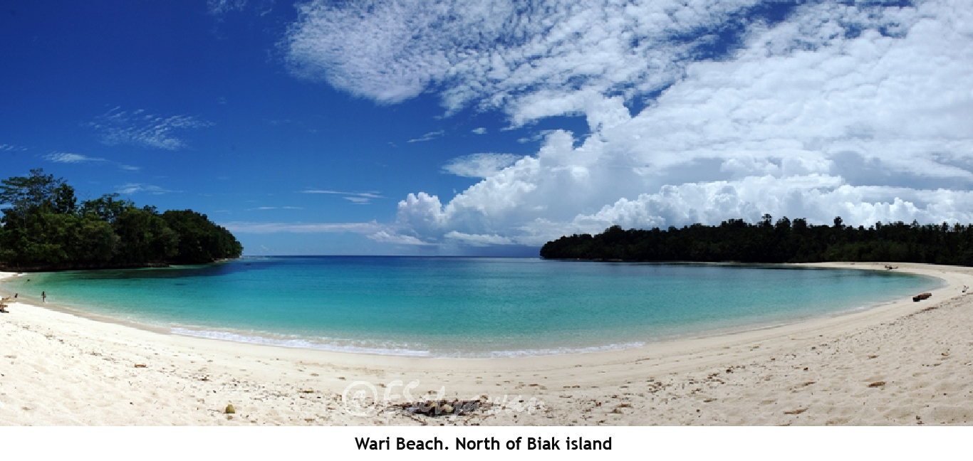
Gedambaan beach is a beautiful beach located in Kotabaru, South Kalimantan. This beach is located in the village of the same name anyway, namely Gedambaan. Gedambaan beach has crystal clear water with a greenish background of hills. Basic shallow sea water can be seen easily because of the clear water beach Gedambaan. Gedambaan beach filled with mangrove trees grow along the coast. It seems that the life of the mangrove trees here on average are older. It can be seen from the size of the stems and roots of the mangrove trees out of the ground. 


8.  Pantai Pagatan (Pagatan Beach)
Pagatan coast, is one of the beaches in South Kalimantan, precisely in Pagatan, Tanah Bumbu. The beach is located approximately 300 km from the provincial capital, Banjarmasin. The beauty of the beaches can be seen immediately when visitors traveling towards Batulicin or Kotabaru, because this beach is located beside the main road trans-Kalimantan. 


9.  Taman Wisata Alam Loksado (Loksado Nature Park)
Loksado natural park located in Hulu Sungai Selatan, South Kalimantan Province. There are four Nature can be visited here, and that Tanuhi Hot Water Tour, Travel Rafting, Travel Balai Adat (11 kinds) and Waterfall (8 units). Loksado natural park is located at the foot Loksado Meratus, is quite good and safe place to visit, 


10. Pantai Angsana (Angsana Beach)

Angsana Beach is a tourist spot located in the district of Tanah Bumbu Angsana, Tanah Bumbu regency, which can be reached by approximately 5 hours by road from the city of Banjarmasin. Precisely are behind palm oil plantations.
The beach is very clean and still relatively virgin and yet so unknown. One of the interesting attractions of this beach is snorkeling and scuba diving where we can see the beauty of the coral reefs that lie offshore not far from these attractions make it obligatory on the list of tourist attractions in South Kalimantan.


11. Pantai Marabatuan (Marabatuan Beach)

This beach is part of the Marabatuan Island, located in the district Pulau Sembilan, Kotabaru District. South Kalimantan Province. Named Pulau Sembilan because this district has nine islands, namely Marabatuan, Denauan, Payungan, Maradapan, Matasirih, Pemalikan, Labuan West, Kalambau and nest. But only Marabatuan island, and the island Matasirih Maradapan islands are inhabited. Beaches in the area have a fairly clear sea
  

Thursday, March 24, 2016

Beautiful Scenery from West Sulawesi


West Sulawesi is a province of the division of the province of South Sulawesi on October 5, 2004. This is the Capital Mamuju. It covers an area of about 16,796.19 square kilometers. Geographically, this province is located in the golden triangle cross position of South Sulawesi, East Kalimantan and Central Sulawesi, as well as directly facing the national and international sailing Makassar Strait. The province has a lot of natural beauty which are as follows:

1. Air Terjun Tamasapi (Tamasapi Waterfall)
Waterfall Tamasapi is located in the hamlet Tamasapi, village Mamunyu, Mamuju Subdistrict, Mamuju, West Sulawesi province.  This waterfall has a height of 75 m. There are waterfalls around the rocks so that they can approach the waterfall.


2.  Pantai Dato (Dato Beach)
Dato beach is located in the hamlet Pangali, Village Baurung, District East Banggae, Majene, West Sulawesi. This beach has a unique addition to having beautiful tropical beach is also fairly unspoiled and properly maintained. Dato beach is divided into two parts, the fine white sandy beaches and coral beach repose. The existence contour rocky coast and juts into the sea. The beach is located approximately 7 km from the town of Majene


3.  Pulau Karampuang (Karampuang Island)
Karampuang island is forested Mamuju city. In addition, the island has also become one of the attractions in Mamuju. Karampuang island located in the District Simboro Islands, Mamuju, West Sulawesi province. Island area of approximately six square kilometers is known for the beauty of the sea. Underwater beauty such as coral reefs and other marine life is an attraction of this island. No need to dive to be able to see the beauty of it.


4. Tebing Paken (Paken Cliff)
Paken is the name of the area with exotic cliffs located in the district Kalumpang. Paken cliff located in Kalumpang, Mamuju, West Sulawesi. To go Paken we need to employ extra hard because they have conquered some of the hills and mountains as far as approximately 7 km. Paken have the form of the cliffs are very beautiful, if observed carefully, these cliffs like having a pattern of human facial features, its sides covered with shrubs and small trees to large.


5. Pantai Palippis (Palippis Beach)
Palippis beach located on the road axis West Sulawesi, precisely in the village of Bala, District Balanipa is about 20 Km from the capital city of Polewali Mandar. Palippis beach is located on the west side of the island of Sulawesi. Face to face with the ocean as a separator between the island of Borneo, Java, and Sulawesi. appeal besides the beauty of the beach and sea views. Another attraction like the bat cave and the expanse of the cliff. The bat cave is located on the hill that runs not far from the beach. Rows of the cliff is not so far from the mouth of the cave bat.


6. Air Terjun Liawan (Liawan Waterfall)
Liawan Waterfall located in the village tradition, District Sumarorong, Mamasa offers exotic beautiful natural scenery and beautiful. This Waterfall has a seven-level staircase steps. The total height of a seven-level waterfall reaches 350 meters. This waterfall is believed the local residents can beautify the face and treat various diseases.


7. Air Terjun Indo Rannuang (Indo Rannuang Waterfall)
Indo Rannuang waterfall located in the village Kunyi, District Anreapi, Polewali Mandar, West Sulawesi province. This waterfall-shaped staircase and easy to explore until the top of the falls, of course, with extra caution due to slippery rocks. This tiered waterfall has a height varying between 10 to 40 meters, 


8.  Pantai Bone Tangngna (Bone Tangngna Beach) 
Bone Tangnga is a beach in the region of Mamuju commonly used traditional events such as a party of fishermen called Mappaande Sasi '. This event is held once a year in March. Mappaande Sasi 'comes from the local language which means giving offerings to the sea. The tradition as a form of gratitude to seafood that has been given as the dominant community of fishermen


9. Pantai Lombang-Lombang (Lombang Lombang Beach)
Lombang Lombang Beach is located within 30 kilometers from the city Mamuju. Lombang-Lombang on the beach you can walk along the fine black sand along approximately 5 km with an average width of 50 meters. On the waterfront can perform a variety of activities, ranging from sand play, playing volleyball, soccer, or just lounging. The beach was clean with not so big waves make this beach is also suitable for you who love swimming and snorkeling. 


10. Jati Gentungan (Jati Gentungan)
Jati Gentungan is a bluish clear streams surrounded by teak. This place is often used as a large bath, located in the village of Gentungan, District Kalukku, Mamuju, West Sulawesi province. Gentungan name comes from the baths are located while Jati name comes from the many surrounding teak trees 

Wednesday, March 23, 2016

Beautiful Scenery from South East Sulawesi


Southeast Sulawesi Province is located in the southeastern peninsula of Sulawesi, is geographically located in the south of the equator and has a land area of 38 140 km² area (3.814 million ha) and aquatic (marine) of 110,000 sq km (11 million ha).
Southeast Sulawesi Province is located in the southeastern peninsula of Sulawesi, is geographically located in the south of the equator and has a land area of 38 140 km² area (3.814 million ha) and aquatic (marine) of 110,000 sq km (11 million ha). Southeast Sulawesi provincial capital Kendari, a town which is right on the bay Kendari. Sulawesi province has many beautiful landscapes that are as follows :

1.  Air Terjun Tamburano (Tamburano waterfall)
Tumburano waterfall is in the administrative area of the village of Tumburano Lansilowo, District of North Wawonii, Konawe archipelago. Tumburano is different from most attractions such as waterfall in Southeast Sulawesi Moramo. Waterfall tumburano has two levels of water terraces, the first terrace has patio peaks as high as 90 meters and was named tumburantama and second terrace 30 meters high and named tumburantina. Discharge of water from tumburano so overwhelming that as it hit the bottom of the river water creates a large vapor in the vicinity.


2.  Danau Towuti (Towuti Lake)
Towuti Lake is a lake located in South Sulawesi, Indonesia. Administratively, the lake is located in the district Towuti, Luwu Timur, Sulawesi Selatan.Kawasan Towuti Lake is part of the Nature Park Lake Towuti. Towuti lake has an area of more than 50,000 Ha is smaller than Lake Toba in North Sumatra, but lake 'Tectonics' in the province of South Sulawesi is listed as the deepest lake in South East Asia with a maximum depth of 203 m.


3.  Air Terjun Laguna (Laguna Waterfall)
This waterfall is located in Sorawolio, about 24 kilometers from Bau-Bau, Southeast Sulawesi and waterfalls even become the most beautiful waterfalls in Indonesia. This waterfall is located in the Village of New Works, District Sorawolio, Bau-Bau, Southeast Sulawesi Province.


4. Pulau Liwutongkidi (Liwutongkidi Island)
Liwutongkidi Island is one of the islands located in Buton. Island area of ​​approximately 1,000 square kilometers memilliki tropical climate with an average rainfall of 1,000 mm per year. Liwutongkidi Island by local governments Buton included as one of the integrated development BASILIKA (Batauga, Siompu, Liwutongkidi, and Kadatua). The aim is to develop a maritime tourist attraction (under the sea) in the district with a rich variety of the baharinya travel. Hopefully, by the BASILIKA region, the passion of wistawan to visit Buton increased. Although the island is not so great when compared with other islands in maritime Buton, the island is able to give a unique feel through the beauty of the beach and underwater charm. Coastline along the island is filled with stunning white sand and feel more beautiful when combined with sea waves were combing the sand. In addition, the natural wealth under the sea on the island is also interesting to visit. Diversity of coral reefs and marine biota in the symphony regularly chime panoramic beauty of the underwater world.


5.  Taman Nasional Wakatobi (Wakatobi National Park)
Wakatobi National Park is a marine national park in Southeast Sulawesi, Indonesia. The name of Wakatobi is an acronym of the four play Tukangbesi Islands: Wangi-scented, Kaledupa, Tomia, and Binongko. This national park It consists of four larger islands: Wangi-Wangi, Kaledupa, Tomia and Binongko, as well as many small islands such as Tokobao, North Lintea, South Lintea, Kampenaune, Hoga and Tolandono. The highest elevation is 274 meters (899 ft) on Wangi-Wangi, Followed by Lagole Hill (271m) on Tomia, Integrated Hill (222 m) on Binongko and Mount Sampuagiwolo (203 m) on Kadelupa. [1] The water depth varies , with the deepest parts reaching 1,044 meters (3,425 ft).
The Wakatobi National Park - the third Reviews largest marine park in Indonesia. Legendary underwater explorer and conservationist Jacques Cousteau is said to have called the Wakatobi islands - then known as the Tukangbesi islands: an "Underwater Nirwana". Now a national marine park covering the entire Waktobi District, it comprises 1.4 million hectares, of the which 900,000 hectares are decorated with different, colorful species of tropical coral reefs. For Wakatobi is Widely Recognized as having the highest number of reef and fish species in the world. The islands are Also famous as the Reviews largest barrier reef in Indonesia, second only to the Great Barrier Reef in Australia. This is the habitat of large and small fish species, the playground of dolphins, turtles and even whales. Wonderful Indonesia: Wakatobi National Marine Park The island group comprises 143 larger and smaller islands where only 7 are inhabited counting a total population of around 100,000, while the others Werner uninhabited. Most notable are the Bajo communities, the Seafaring nomads who Inhabit many of Indonesia's remote islands.


6. Pulau Kabaena (Kabaena Island)
Kabaena or Tokotua is one of the islands in the region Bombana, Southeast Sulawesi Province, Indonesia. Island with a land area of about 873 km². The island is included in the islands have beautiful natural pemandanagan, one of which is its coastal region


7.  Air Terjun Moramo (Moramo Waterfall)
Moramo waterfall is a multilevel waterfall (cascade) were wonderful with a height of about 100 meters. From that height, the water flows through the seven main levels. In addition to the seven main levels, there are also 60 small levels that also functions as a reservoir of water (such as water pools). Of the many pools, the only one that can be used for swimming, the pool is located on the second level of 7 main levels of the waterfall
Moramo Waterfall Located in Tanjung Peropa Forest Nature Reserve, in the village Sumber Sari, District Moramo, Konawe South, Southeast Sulawesi Province.


8. Danau Biru (Blue Lake)
Blue Lake is approximately 164 meters in diameter, taste the water is brackish and quite cold. maximum depth of only 7 meters, if you snorkling observe species of fish, the lake bottom can be seen clearly. Blue Lake is situated in the village. walasiho Wawo District of North Kolaka.


9. Danau Napabele (Napabele Lake)
Napabale Lake is a lake located in Muna, Sulawesi Tenggara, Indonesia. Located at the foot of the hill, connected to the sea through a natural tunnel. At low tide the visitors can pass through the tunnel. However, if the tide sea water was very dangerous for swimming because the sea water will rise to a height of half a meter above the natural tunnel. The Napabale lake located ± 15 km from the capital city of Raha Muna.
The tunnel is on this lake has a long spans of 30 m and width of 9 m. These tunnels connect them chunks of the lake with the high seas.


10. Air Terjun Kandawu Dawuna 
(Kandawu Dawuna waterfall)
Kandawu dawuna Waterfall located ocated in rural districts wakulli Kapontori Buton. Buton Island is an area with natural potential is amazing. Places have mentioned in the state Kertagama made by Prapanca MPU. The island has the potential asphalt Most serious in the world.

Tuesday, March 22, 2016

Beautiful Scenary from Papua


Papua is a province of Indonesia located widest in the central part of New Guinea or the most eastern part of West New Guinea (Irian Jaya). The eastern parts of the country Papua New Guinea or East New Guinea. Papua island has an area of about 421,981 km2, the island of Papua is located at the eastern end of the Indonesian territory, with the potential of natural resources and strategic economic value, and has pushed the nation - foreign nation to master the islands Papua.Kabupaten Puncak Jaya is the highest town on the island of Papua , while the lowest town is the town of Merauke.
Papua province has many beautiful natural scenery and some of them are as follows:

1. Danau Sentani (Sentani Lake)
Sentani Lake is a lake located in Papua, Indonesia. Lake Sentani is under slopes of the Cyclops Mountains Nature Reserve has an area of approximately 245,000 hectares. This lake lies between the city of Jayapura and Jayapura regency, Papua. Lake Sentani which has an area of approximately 9,360 hectares and is located at an altitude of 75 meters above sea level. Lake Sentani is the largest lake in Papua with a maximum length of 28 km (17 miles) and from north to south, 19 kilometres (12 mi) of breadth. With a surface area of 104 square kilometres (40 sq mi), In this lake also there are 21 small islands adorn this beautiful lake. Lake Sentani rich variety of marine life and is already used for freshwater fish farming. Lake Sentani is also used as a tourist location for swimming, boating, diving, fishing, water skiing and culinary tours.


2.  Pantai Bosnik (bosnik Beach)
Segara Indah Beach better known by the name Bosnik beach is located in the eastern side of the Biak island, in the village Woniki, East Biak, Biak Numfor, Papua Province. The white sandy beach is a famous tourist spot and visited by residents and visitors Biak itself.
No wonder if the beach is visited because besides scenery beautiful beaches, the beach there is also a beautiful coral reef to behold. You can swim, snorkel or just soaking up the sun on this beach.


3. Taman Nasional Wasur (Wasur National Park)
Wasur National Park is representative of the most extensive wetlands in Papua / Irian Jaya, which is located not far from the town of Merauke. This national park has an area of 4.138 km² (413 800 hectares). This national park region has most extensive wet savanna forests in Indonesia and even Asia are rich with various types of rare flora and fauna and is a haven of Junai that migrant birds from northern Australia. In addition a number of rivers that encircle the park area mrupakan a breeding ground for the type of snapper and arowana. In this garden thrives various types of mangrove trees (mangrove), bamboo and sago


4. Danau Paniai (Paniai Lake)
Paniai Lake is a lake located in the district of Paniai, Papua or administratively located in the district of East Paniai. Spacious Lake Paniai which reached 14,500 hectares gives enough space for tourists to choose a location that is in accordance with his wishes when outing to the lake. The presence of rocks and sand at the edge of the lake, and surrounded by cliffs are quite high, adds to the appeal flagship attraction Paniai this. As most of the topography Paniai which is in the mountains and hills that cool temperate, Lake Paniai was located at high altitude, which is about 1,700 meters above sea level (asl).


5. Pucak Jaya (Cartenz Pyramid)
Puncak Jaya or Carstensz Pyramid (4,884 m) is the highest summit of Mount Carstensz  in the Sudirman Range of the western central highlands of Papua Province, Indonesia (within Puncak Jaya Regency). Other summits are East Carstensz Peak (4,808 m), Sumantri (4,870 m) and Ngga Pulu (4,863 m). At 4,884 metres (16,024 ft) above sea level, Puncak Jaya is the highest mountain in Indonesia.
While Puncak Jaya’s peak is free of glaciers, there are several on its slopes, including the Carstensz Glacier, the Meren Glacier, and Northwall Firn. Being equatorial, there is little variation in the mean temperature during the year (around 0.5°C) and the glaciers fluctuate on seasonal basis only slightly.    


6. Telaga Sarawandori (sarawandori Lake)
Sarawandori lake is a lake located in Serui, Yappen Islands, Papua. This lake is a connection from the bay Sarawandori. Nearby residents call this lake because they think the water in the lake comes from under the ground instead of the ocean. This lake is very beautiful with colorful water. 


7. Pulau Nutabari (Nutabari Island)
Nutabari Island is an island of white sand locked in Cendrawasih Bay National Park. Nabire reached from the city for about two hours by high-speed seedboat. In addition to a gently sloping beach, clear water, silent and still, there was nothing on this island. 


8. Sungai Mamberamo (Mamberamo River)
Mamberamo River is a river located in the south of the Foja Mountains, Sarmi, Papua Province .. Mamberamo river has a length of about 670 late km. Tens of kilometers along the estuary, river basin extends to the 520-meter. Landscape around this river varies. In areas such as steep mountains upstream, downstream areas are terrain is swampy, and in the central part of the basin in the form of broad plateau 


9. Pulau Numfor (Numfor Island)
Numfor is an island located on the north island of New Guinea. Administratively, numfor including Noemfoor Biak regency. The island is located in the north of Papua. Located in Paradise Bay within fifty kilometers west of Biak and Supiori and 70 km east of the port city of Manokwari. This island is almost oval shape and has an area of 335 square kilometers. At some point, the island has a fairly clear sea


10. Pantai Wari (Wari Beach)
Wari in the northern coast of Biak. Here you will be spoiled with sea water shades of blue, Tosca, blue. to dark blue. Beaches in Wari area has a white sand area not terlaluluas with the roar of the waves are not too tight is not always quiet. Unique, limited only pile of white sand, lies the freshwater of the river bank which is not far from the beach


11. Pantai Harlem (Harlem Beach)
Harlem beach is a beach located in the village of Tablanusu in Depapre District, Jayapura regency, Papua. This beach is one of the main of the many beaches that lie in around the village. Nonetheless Harlem Beach may have positions slightly recessed and has a marvelous white sand beach,. The beauty of the beach Harlem are not yet spread widely

Sunday, March 20, 2016

Beautiful Scenery from South Sulawesi


South Sulawesi is a province of Indonesia, located in the southern part of Sulawesi. The capital city is Makassar, formerly called Ujung Pandang. Location of South Sulawesi region located in the south of Sulawesi island bounded Northern West Sulawesi, East of the Gulf of Bone and Southeast Sulawesi, West of the Straits of Makassar, South side Flores Sea. This province area is 46717.48 square km. South Sulawesi has a lot of beautiful scenery and are as follows :

1.  Danau Tempe (Tempe Lake)
Tempe Lake is a lake located in the western part of Wajo, South Sulawesi, precisely in the District Tempe, District Belawa, District Land Sitolo, District Maniangpajo and District Sabbangparu, located about 7 km from the city of Sengkang to the banks of the River Walanae and covering three districts of lakes Tempe has an area of approximately 13,000 hectares, which is flanked by three districts, namely Wajo, Sidrap and Soppeng. Lake Tempe has a freshwater species that are rarely found elsewhere. This is because the lake is situated above the Australian continental plates and is one of the Asia.Danau tectonic lakes in Indonesia.


2.  Pulau Selayar (Selayar Island)
Selayar Island is located at the tip of South Sulawesi province (The island is located in the southern and takes 10 hours sea sailing trip from Makassar), there will be available island wide with white sand and clear waters. Although still dominated by rainforest, Selayar Island offers plenty of white sandy beaches, this island. has a length of 80 kilometers and is the gateway to the beauty of the National Park Taka Bonerate. Stored underwater in the colorful corals, giant sponges, and diverse fish species such as dugongs, tuna, turtles and manta rays. Selayar consists of 21 islands and atolls, where Taka Bonerate is the third largest atoll in the world after the Marshall Islands and the Maldives.


3. Air Terjun Takapala (Takapala Waterfall)
Takapala waterfall is one of the tourist destinations of the Region Malino own. It is located approximately 5 km from Malino Highland tea plantation in the village Bulu'tana Tinggimoncong District of Gowa. To achieve Niagara Takapala, simply walk through the tea gardens without the need to return to the exit.
Niagara Takapala is one of two waterfalls owned Malino. Niagara Takapala has a height of 100 meters with a flow of water large enough to create a fog around 20 meters, so do not be surprised if you can see the light like a rainbow in this waterfall. And around the waterfall there are steep cliffs with a unique style that makes an impression of the waterfall still appeared natural.


 4. Pantai Tanjung Bira (Tanjung Bira Beach)
Tanjung Bira is located right at the foot of the island of Sulawesi were around him there are islands that did not lose his gorgeous as Goat Island, the island screen, make the island of Tanjung Bira Liukang Loe very interesting to visit. Tanjung Bira beach is located approximately 200 kilometers from Makassar city center can be reached within five hours by car 


5. Danau Matano (Matano Lake)
Matano Lake is a tectonic lake with a length of 28 kilometers and a width of 8 kilometers in South Sulawesi, precisely located on the southern tip of the island of Sulawesi in the city Sorowako, Luwu Timur.
The lake has a depth of clear water as far as 590 meters (1,969 feet). The water surface of the lake is at an altitude of 382 meters above sea level so the water depth of the lake is 208 meters above sea level (cryptodepression). According to WWF, this lake is the deepest lake in Southeast Asia and the eighth deepest in the world. The uniqueness of the lakes, ecosystems and biodiversity is endemic make Lake Matano Global Ecoregions included in the category by the World Wide Fund for Nature. 


6. Pulau Cangke (Cangke Island)
Cangke Island is one of the islands in the Archipelago Spermonde. Geographically, the island Cangke included in the district of Pangkajenne Islands. The island can be reached in three hours from Port Paotere Makassar with wooden boats. Cangke island is famous for its beautiful coral reefs, do not need to dive to enjoy, simply by snorkeling. Guaranteed you'll like baseball. Cangke island also offers the beauty of the sunrise and sunset because both we can see from both sides of the island. Since the island is small, so quite a walk just to surround him. With luck and a fitting season, you can also see turtles laying eggs. 


7.  Air Terjun Parangloe (Parangloe Waterfall)
Parangloe waterfall located in Parangloe, Gowa regency of South Sulawesi, about 30 km from the city of Makassar directions to Malino. The sound of thundering water, clear water flowing, cool atmosphere, fresh air, beautiful scenery, can directly look and feel. For in the South Sulawesi, may  Parangloe Waterfall is the most beautiful because it has a terraced waterfall, suckler attractive stone and its clear water. 


8.  Taman Nasional Bantimurung 
(Bantimurung National Park)
Bantimurung-Bulusaraung National Park has an area of ± 43,750 Ha. In public administration, this national park is located in the district of Maros and Islands District Pangkajene (Pangkep). Currently managed by the Bantimurung-Bulusaraung National Park, which is located in the district Bantimurung, Maros, South Sulawesi. Bantimurung-Bulusaraung National Park has a variety of unique, namely: karst, caves with beautiful stalactites and stalagmites, and the best known is the butterfly. Bantimurung by Alfred Russel Wallace dubbed as The Kingdom of Butterfly. This National Park is one tourist destination that presents nature in the form of a steep limestone hill valley with tropical vegetation, waterfalls and caves which is a habitat for various species. At least this national park has more than 80 natural caves and prehistoric cave scattered in the karst region Bantimurung-Bulusaraung National Park. 


9. Pulau Samalona (Samalona Island)
Samalona Island is a small island located in the district of Ujung Pandang, Makassar, South Sulawesi province. The distance is about seven kilometers from the city of Makassar.
Samalona island has a beach with white sand. Sea water is still pure blue. On this island there are many coconut trees which adds to her beauty. Samalona island is also famous for the beauty of the underwater world. Besides swimming, you can also dive / diving here. Still beautiful coral reefs with fish colorful sea.In addition, the island is also a mystery about the sinking of a ship relics of World War 2. There are at least seven ships were sunk in the area of ​​the island. Among them is the Maru ship (a Japanese warships were sunk at a depth of about 30 meters), Lancaster Bomber Ship, Cargo Ship Hakko Maru made in the Netherlands and several other vessels. Currently these vessels has been transformed into a reef and is home to hundreds of marine life.


10. Taman Nasional Taka Bonerate 
(Taka Bonerate National Park)
Taka Bonerate National Park has the third largest coral atoll in the world. Size atoll is about 220,000 hectares, with a coral reef flat area of 500 km². This area is located in the District Takabonerate, Selayar Islands Regency, South Sulawesi, Indonesia
Topography of the region is very unique and interesting, where the atoll consists of a cluster of islands reefs and reef flats are spacious and sinks, forming islands with a considerable amount. Among the islands reefs, narrow straits there is a deep and steep. While on the surface of the reef, there are many small pools of deep and surrounded by coral reefs. At low tide, it was clear dry land interspersed puddles that formed small pools. A total of 15 islands in the National Park Taka Bonerate do diving, snorkeling, and other marine tourism.


11. Pantai Kasuso (Kasuso Beach)
Kasuso beach located in the village Darubiah, District Bontobahari, Bulukumba regency, South Sulawesi. The beach is dotted with white sand beaches and their Tallasa Stone (Stone floating) next to the South, long white sandy beaches in Kasuso reaching 1 kilometer. Another interesting point of Kasuso is the presence of a stone that resembles a giant umbrella that stands firmly in the sea. The stone called the Stone Taha (stone fringed) hallowed by citizens Kasuso.


12. Danau Tanralili (Tanralili Lake)
Tanralili lake is one of the sights that have not been exposed long existence. The lake is located in the hamlet Lengkese. Precisely in the village Manimbahoi, Parigi districts, Gowa regency, South Sulawesi. Approximately 1 ½ hours from the town of Malino to get to this village uses two or four-wheeled vehicles. If friends been to the waterfall or waterfall Takapala meet a mate, then Lengkese hamlet not far from where it is approximately 45 minutes drive. Tanralili lake formed by Bawakaraeng Mountain avalanches that occurred in 2004. When an avalanche occurs basin formed deep enough